Day 17 to Day 22 - Sun and rain and... hail?!
Us blog tech guru's apologize for the long delay in publishing pictures and text from the last week of hiking. We adopted two kitty cats, and they are a bit distracting. They especially love walking over my laptop's keyboard whenever I want to type.
Tuesday April 10th
Susan:
"Well, I can't believe we actually made it to NC!! My back and legs are really hurting, perhaps I need to get my pack lightened again. :) It's been tough going, and Reflex is hiking nine miles today while I take a zero (Tech Guru's note: she actually walked ~6 miles around town, so this really isn't a "zero" day...). My lower back needs a little rest. I am staying in Baltimore Jack's Hostel in Franklin, NC."
Sam's AT Mileage Tracker: Day 17 Mile Marker 84.8 to 93.3 to reach Carter Gap Shelter
View from Indian Standing Mountain
Side 1: Dragon!
Side 2: Gator!
Baltimore Jack's Hostel in Franklin, NC
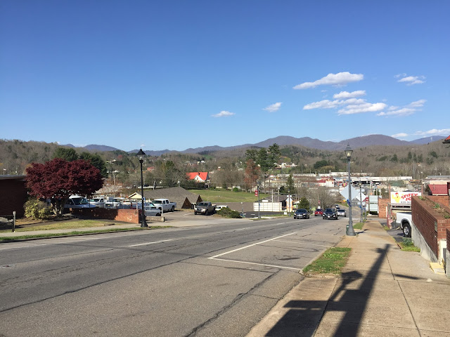
Franklin, NC - Very hilly and VERY hiker friendly people. :)
Wednesday April 11th
Sam's AT Mileage Tracker: Day 18 Mile Marker 93.3 to 109.2 to reach Winding Stair Gap
Susan:
"After Reflex climbed up Albert Mt, with 0.3 miles straight up with her pack on, we then went from Rock Gap to Winding Stair Gap (4 miles)."
View on the way to Albert Mountain
View from Albert Mountain
Albert Mountain Fire Tower - 0.3 vertical climb to the top
Sun on the AT... Oh my!!
Signs.. Are you going the right way? :)
Thursday April 12th was a zero day! But again, because everything is so spread out in town we ended up walking over 6-7 miles.
Friday April 13th
Sam's AT Mileage Tracker: Day 20 Mile Marker 109.2 to 120.2 to reach Wayah Bald Shelter
Susan:
"Reflex and I are back on the trail and we hiked 11 miles to Wayah Bald Gap Shelter. We actually were able to stay in the shelter overnight and met up with some people we saw before, which is always fun. There are so many nice people out here."
Enjoying the sunshine after a day of rest... AND we're having fun, too!
Left: Notice the pipe with running water? This will be really tasty.... We treat all of our water with a filter to remove all the unwanted nasties. Right: Waterfalls like this are everywhere as a result of all of the rain.
Left: Another interesting tree along the way. Right: Wayah Bald Tower. Getting to the end of a very long day. Almost to the shelter for the night!
Saturday April 14th
Sam's AT Mileage Tracker: Day 21 Mile Marker 120.2 to 128.6 to reach Tellico Gap.
Susan:
"Today we hiked 8.4 miles to Tellico Gap where we were picked up to stay at Nantahala Aquone Hiker Lodge. It was a beautiful, clean, and friendly place! AND I deserve a metal. I'm exhausted, and I can't believe I have to again tomorrow. Lol."
Sam/Reflex:
"Can't wait to do it again tomorrow! And the next day. and the next.. and the next!!"
Back on the trail to Tellico where we have a ride to Nantahala Mountain Lodge to slack pack before the Smokies.
Trail Magic brought to us (and others, of course) by the Burningtown Baptist Church. Hot chili, hotdogs, slaw, salad, homemade cookies, and drinks. HEAVEN!! This gave us the strength to go the last give miles to Tellico Gap.
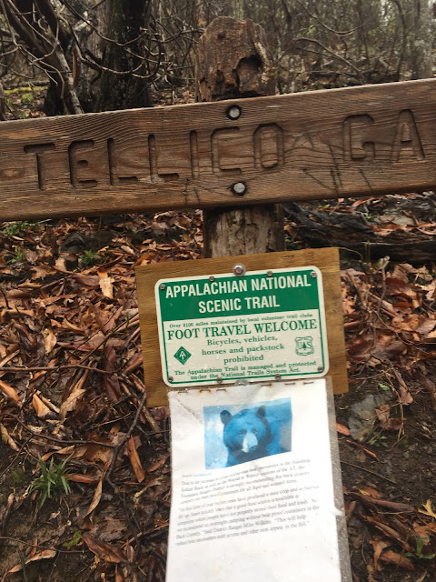
In the event that you cannot read the paper note below, it reads: "Due to an increase in close and serious bear encounters in the Standing Indian Basin as well as the Wayah to Wesser sections of the AT, the Nantahala Ranger District is strongly recommending that back country campers use bear proof containers for all goods and scented items. 'At this time of year before trees have produced a mast crop and as berries dry up, bears quickly learn that a good food source is available at campsites where people have not properly stored their food and trash. So we recommend no overnight camping without bear proof containers in the Back Country,' said District Ranger Mike Wilkins. 'This will help reduce bear encounters until acorns and other nuts appear in the fall.'" Really helpful, right? Encouraging, too. Anyone want to join us? Maybe bring a bear-proof container or two?
Sunday April 15th
Sam's AT Mileage Tracker: Day 22 Mile Marker 128.6 to 136.7 to reach NOC.
Susan:
"We slack packed 8 miles to the NOC. It was very windy and we had the pleasure of hiking through hail and rain all day. We had a nice, late lunch along the Nantahala river, despite the poor weather."
Weser Bald Observation Tower. Up she (Reflex) goes! The wind is blowing and it's raining and hailing. But the hike must go on, we are out here and doing our thing! Reflex is beginning her climb of the observation tower on the left, and on the right she has conquered it!
Onward and looking quite fashionable in our Gore Tex. This stuff is great, keeping us (mostly) dry and quite warm!
Even with the clouds/rain/hail... What a view!


Thanks for the new posts! was getting worried, checking on you guys everyday! So happy you got a little time to relax at the luxurious hostel! LOL! You are both still smiling and hiking! Keep going girls! You’ve got this!! Love the beautiful views! Rebecca
ReplyDeleteStay safe and have fun. The pictures are great, and Sam climbing that tower with her pack that's crazy. See you in six months, be careful.
ReplyDeleteYou ladies are too funny😂 so happy for you, 200+ miles!!
ReplyDeleteJust keep walking 😅😁